Provided with seed money from the California
Space Institute and National
Science Foundation, Linnea Avallone, Tara Fortin, Ralph Kolbush and
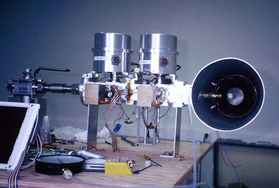
I constructed a pumping system and special inlet that would allow us to
measure bromine and chlorine atoms by a technique that, in the presence
of water vapor and oxygen, only works at low pressures. To achieve high
flow rates, we used a rotary vane pump to pull ambient air through a small
(~ 2 mm) orifice in a conical teflon nozzle. To ensure that we were sampling
clear air, with little shear, the flow was first straightened by a cylindrical
tube backed with an axial fan. The fan, straightening tube, and detection
axes are shown in this photo.
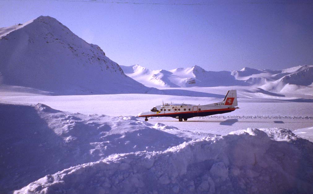
Unfortunately, the Greenland Sea was frozen over by the
time we finished modifying the instrument, so we had to ship everything
by small plane. This restricted the size of the vacuum pump to one smaller
than was optimal for the measurement. The airplane is shown on the runway
in this view to the south from the "parking lot", with Zeppelin Mountain
at the left.
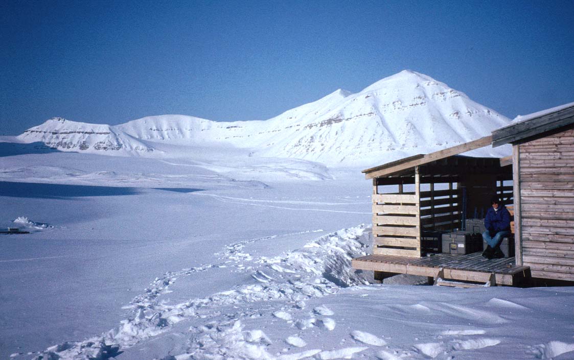
We set the instrument up about 10 meters east of the "Blacksmith's
Shop" to the southwest of town. This view is to the southwest. It took
about 5 hours to shovel enough snow to fill the 1 meter deep "gap" between
the snowpack and the building. It then took another day or two to assemble
and test the instrument. Somewhere on the ridge in the background in this
photo is the retroreflector for one of the two DOAS instruments.
Karena McKinney and Tara Fortin then spent the second half
of April and the first week of May operating the instrument during good
and bad weather. The data were stored on a hard-drive that had to be backed-up
periodically, resulting in gaps in the data record. In addition, in order
to preserve the lamps (which are run "bright" and tend to burn out relatively
fast on our balloon and aircraft instruments) we set the system up for
lower sensitivity and Karena and Tara ran the instrument daily, but not
continously until they observed a real "ozone loss" event, which occurred
the first week of May as the campaign was winding down.
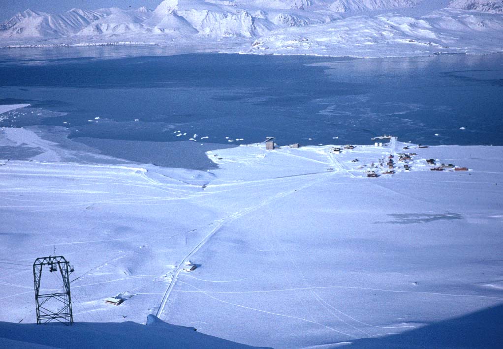
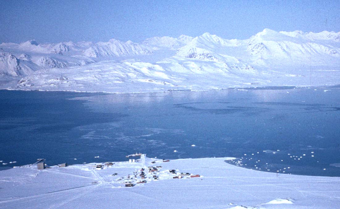
The Blacksmith's Shop is the building in the lower left
corner of this photo looking down and to the north from Zeppelin Mountain.
We were close enough to town that we didn't need to take a rifle with us
(for protection from polar bears) as we commuted back and forth to work.
Our measurements were near the ground. Two DOAS spectrometers were measuring
BrO and ClO, one with a path from town (in the upper right in this photo)
to a retroreflector to the southwest, and nearly directly overhead of our
location. The other DOAS was measuring from the airport (at the middle
left in this photo) to a location across the fiord (upper middle of the
photo). Our main goal was to determine how well our measurements agreed
with the others, although we did not expect to necessarily be measuring
in the same air.
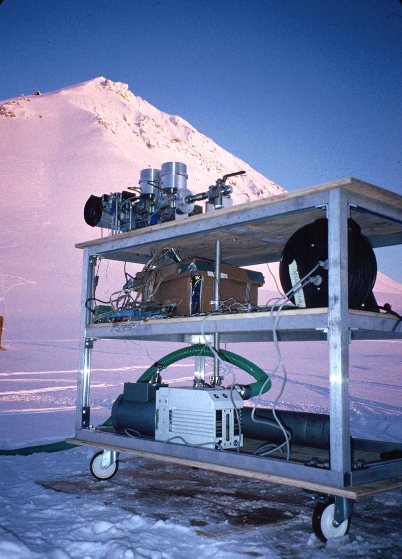
The instrument, as it was deployed, is shown in this
photo, a view to the south. The detectors are at the top of the cart. The
computer and data acquisition system were packaged in an insulated cardboard
box, and placed next to the 24 V power supply on the second shelf. The
vacuum pump and a bottle of nitric oxide are on the bottom shelf. The data
were relayed by a serial line back to a heated room in the Blacksmith's
Shop. The exhaust was filtered to remove oil and particulates, and directed
away from the instrument by a long piece of flexible tubing, with the end
placed in the snow. This was necessary to minimize contamination from the
nitric oxide used to convert ClO and BrO to halogen atoms.
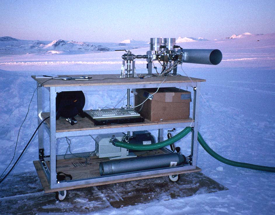
This is the front view of the instrument, also looking
to the northeast. At this sun angle (about 9 pm, local time) our measurement
was shaded by the Blacksmith's Shop, whereas the paths of the DOAS instruments
were in full or partial sunlight. This arrangement resulted in some complicated
behavior in the ratios of our measurements to those of the DOAS instruments,
and confused us until we pulled out a topographic map to determine when
each of the measurements were in sun or shade. Sometimes our measurements
were higher than the DOAS measurements, and sometimes their's were higher
than ours. Next time we do this experiment, we'll bring a solar flux monitor
(and measure both diffuse and direct radiation).
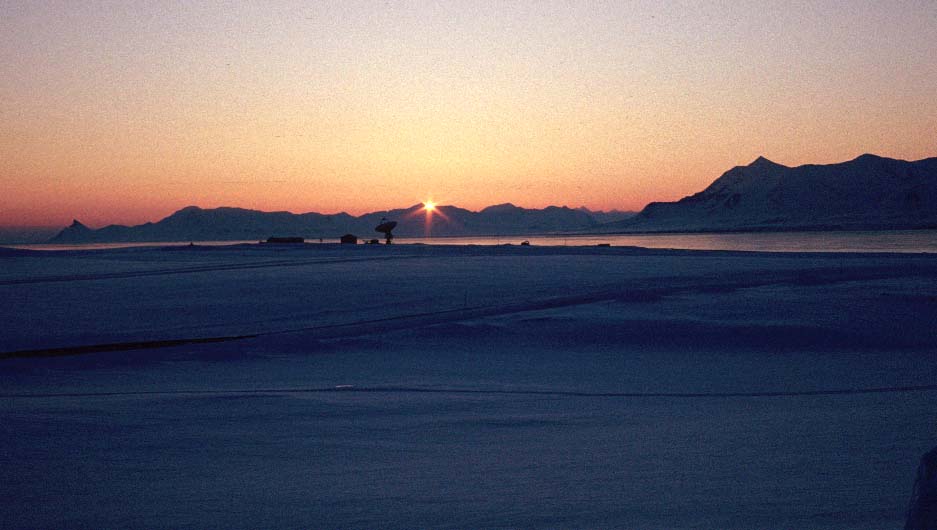
The local topography complicated the intercomparison
especially in the middle of the "night". This photo was taken about an
hour before local solar "midnight." Between about 10 pm and 4 am, the sun
travels along a ridge of mountains on the north side of the fiord, alternately
appearing in valleys and disappearing behind peaks. The long shadows cast
by the mountains did not necessarily aling with the DOAS and in situ measurements.
Therefore, our best intercomparisons were in the middle of day when the
sun was higher in the sky and all instruments were in bright sunlight.